Stand on the shore at Baku and the water looks like any sea. It isn’t one, or at least nobody can agree that it is. The Caspian stretches nearly 750 miles (1,200 km) from north to south, averages 320 km across, and holds some 78,200 cubic km of water. Britannica puts that at about one-third of Earth’s inland surface water.
Big, salty and shut in
Its surface area depends on who is measuring. Britannica gives 386,400 square km, larger than Japan. Live Science, which leaves out the lagoon-like Kara-Bogaz-Gol, lists 371,000 square kilometers. Either way it is the largest inland body of water on the planet.
The sea has no natural outlet. More than 130 rivers feed it, none from the east, and the Volga alone supplies about 80 percent of the inflow according to Live Science. Britannica counts the Volga, Ural and Terek together at about 88 percent of all river water entering the sea. All of that fresh water pours into the shallow north, where the average depth is only 4 to 8 metres. The south is another world: the deepest point lies 1,025 metres below the surface, and the surface itself sits some 27 metres under sea level.
The salt is uneven too. Salinity rises from 1 part per thousand near the Volga outlet to an average of 12.8 across the sea, and reaches 200 in the Kara-Bogaz-Gol, where evaporation is fierce. The North Atlantic, by comparison, runs at 37.
The name comes from the ancient Kaspi peoples who lived west of the water. Britannica adds that around 11 million years ago the basin was still joined to the world ocean through the Sea of Azov, the Black Sea and the Mediterranean.
Oil, caviar and a lot of pollution
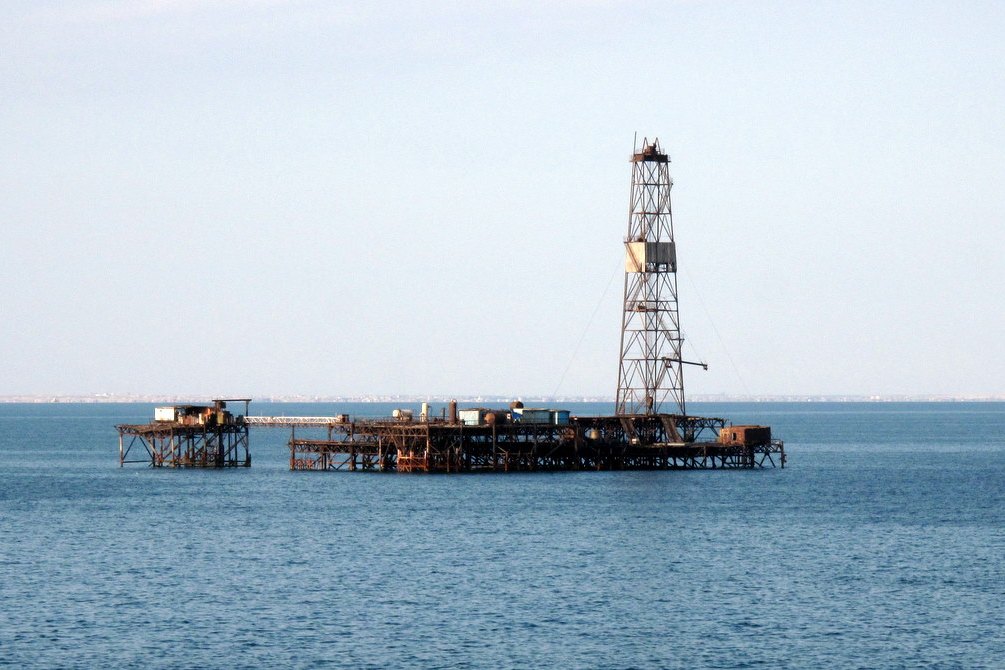
Small oil wells already dotted the shore by the 10th century. The first offshore well was drilled in 1820. Today petroleum, natural gas, shipping and fisheries carry much of the regional economy.
The beluga sturgeon tells the other half of the story. Most of the world’s beluga caviar comes from the Caspian, and overfishing, dams that wrecked spawning grounds and pesticides have left the fish critically endangered, according to the World Wildlife Fund as cited by Live Science. Industry adds to the strain: about 1 million cubic meters (264 million gallons) of untreated industrial wastewater goes into the sea every year.
Water levels have never been steady. Over the span from the mid-19th to late 20th century they swung by more than 12 feet (3.6 m), and the 1977 flood caused widespread destruction. Dams on the Volga system have shifted the balance further, Britannica notes.
Lake or sea?
Five countries share the shoreline: Russia, Azerbaijan, Iran, Turkmenistan and Kazakhstan. The label matters more than it sounds. There are no internationally agreed definitions for seas or lakes, and the Caspian fits neither cleanly, since it is salty but cut off from any ocean.
Hanna Zimnitskaya, writing in the Journal of Eurasian Studies in 2011, argued that the answer carries political and economic weight. If the Caspian is a lake, United Nations and international law have no control over its waters. If it is a sea, international organizations can have a say in how it is used.
Michael Kukral, a geography professor at the Rose-Hulman Institute of Technology, calls it a lake, as do many scholars. “It is the world’s largest lake,” he said, and by that reckoning it holds 40 percent of all lake water in the world. He also points to what sits underneath: “Petroleum resources around and under the Caspian Sea make it an economic natural resource and a political issue of access and ownership.”
Disputes among the five states make even the cleanup hard. Who manages water quality, and who benefits from the oil, remain open questions.
Sources
- Caspian Sea | Facts, Map, & Geography | Britannica
- Caspian Sea: Largest Inland Body of Water | Live Science